During the second ration period, which was 8 days, we continued west through Canal Baker toward Canal Messier. Our original plan was to cross Canal Messier and explore the archipelago that is further west. But it can be a big commitment to cross Canal Messier because it runs north and south and tends to funnel the weather. So, just because you get a good window to cross one direction doesn't necessarily mean you'll have an easy time crossing back. So, because of the amount of time left in the course and the other goals we had in mind to accomplish with our remaining days, we decided to set our sights for Isla Sombrero to the north and go check out that Island.
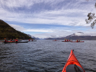 |
| Crossing Canal Baker toward Isla Zealous |
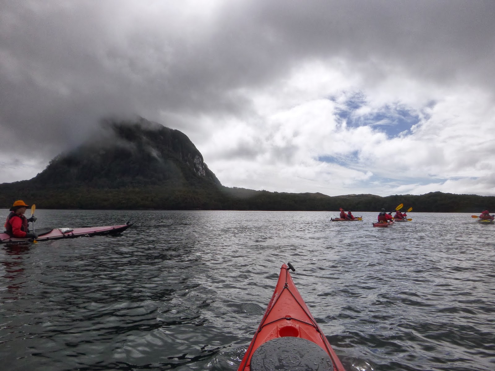
On my birthday, which was October 29th, I woke up to a beautiful sunrise! A very nice birthday gift! The previous day had been very calm and great for paddling, especially for crossing Canal Baker. But you know the saying, "Red sky in the morning, sailors (and kayakers) take warning." As we loaded our boats and began to get on the water that morning we noticed the wind picking up in the distance. In fact, you can see a faint wind line on the horizon in this picture to the right. We needed to paddle north 15 miles or so to get to Isla Sombrero, but as we made our way the wind continued to build. We travelled for several miles and hadn't seen a good pull out in a while and knew there might not be much until Isla Sombrero. But getting to Isla Sombrero required several more miles of kayaking and a one mile crossing in more exposed waters. So, in light of the circumstances and building weather conditions, we decided to turn around and head back to a beach we saw along the way in our first two miles of travel. This beach we nicknamed "shrimp beach" due to the little shrimp-like creatures that were hopping all over the beach at night. We spent one night there and hoped to have a window to travel the next day.
 |
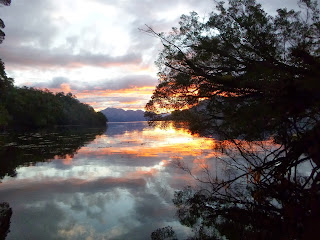
| Isla Sombrero in the distance... |
When we woke up the weather was blustery and we could see some wave action in the distance. We decided to watch the conditions while we cooked breakfast and then meet again to make a decision as to weather to pack up camp and give it a try. At 8:00 am, after eating some breakfast biscuits and drinking our coffee, we decided to pack up and give it a go. Once we were on the water we still had some wind coming and going, but if it didn't deteriorate much we thought we'd be successful. Once we got to the area that we would have to make our crossing from, we could see more white caps and were feeling more energy in the water, so we retreated to a protected cove to make a decision. While we sat in the cove eating our snacks and drinking water, the weather began to improve-just a little bit. A few more minutes went by and we decided to paddle out again and look at the crossing one more time before committing to it. Sure enough when Isla Sombrero was in view we could see the sea state between us and the Island was much calmer than just 30 minutes ago, so we started our crossing. As we travelled the water became calmer still as we neared the lee shore of Isla Sombrero. There was a residual swell of 1-2 feet wrapping around the island from the open ocean to the north, so landing on much of the rocky shore line wasn't an option.
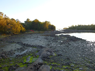 |
| Rock wall made by indigenous people long ago. |
We could see from the chart that there was a small bay indicated in the center of the southern shoreline. We decided that was our only good option at this point and so we headed for it. There was a lot of kelp growing in the water and the view to the west was beautiful! As we neared the small cove I could see that it was going to be a nice protected spot to land. What a good feeling to paddle into protection! Sure enough there was plenty of room to land our boats and we began to scout for camping options. Right away I noticed a rock wall in the intertidal zone that indicated this was an area frequented by the indigenous people long ago. They would build fish traps on these shallow beaches -- at high tide the fish would swim in through an opening and then they would use a woven net to block the exit as the tide dropped back down. It also appeared that the indigenous people had cleared spaces on this beach to land their canoes. It looked like three neatly prepared parking spots at low tide.
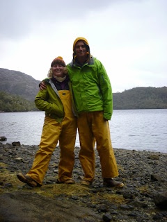
Our scouting had revealed some nice camping options in the woods, which was great. We decided since the next day was Halloween and one of our student's birthday (Jimmy) that we would take a layover day and spend two nights here. We got to sleep in a little bit and then met for some classes and reflection time the following day. Then in the afternoon we got on the water in the protected bay and practiced some self rescues and bracing skills in the single kayaks. The sun even came out!! By evening time we cooked dinner and then met for a little Halloween party and birthday celebration. I'll see if I can get a few photos of the costumes in my next post. Once we went to bed that night the wind began to blow pretty hard and huge gusts ripped through the trees throughout the night. Thankfully we had nice protection there in the woods. Then at about five o'clock am the last gust blew and the weather calmed down a lot. We watched the weather for a little while and then decided to pack up camp and move... the adventure continues....


No comments:
Post a Comment